Oil & Bone: American Ports in the Golden Age of Yankee Whaling
By Kerry Gathers, University of Kentucky.
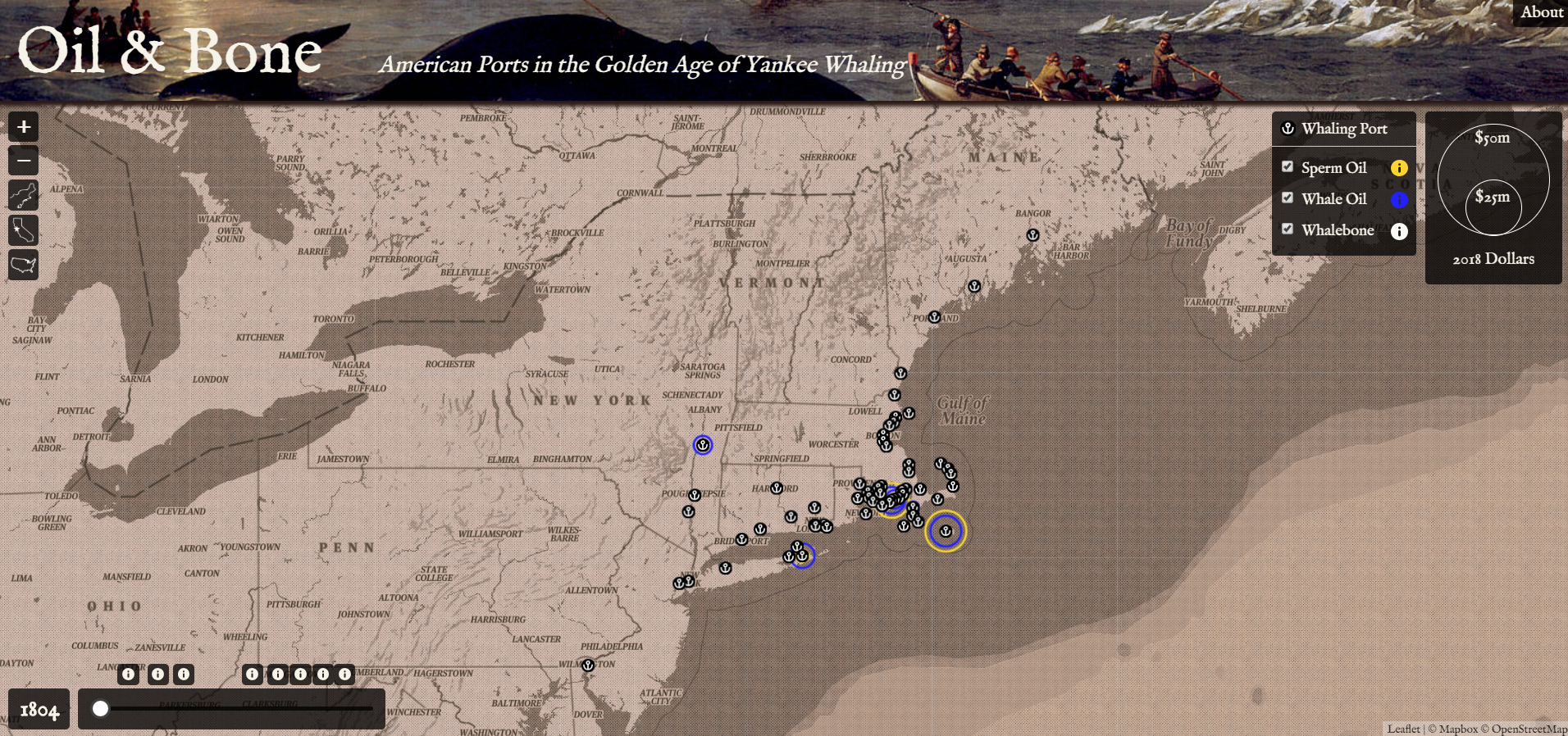
At its peak in the mid-19th century, whaling was a gigantic, global business that provided oil to light the streets and homes of Europe and America, and bone to make profitable consumer goods for sale around the world. The young United States dominated this whaling industry, and for a time, whaling was the fifth largest sector of the American economy. While great mapping has been done to visualize the routes of whaling voyages of this era, this map aims to communicate the economic impact of whaling back in American ports, where sperm oil, whale oil, and whale bone (or baleen) landed and entered the market.
For over 60 port cities, this map illustrates the market values of whale products as they are returned to port. A range slider allows the user to explore changes and trends in the whaling economy from 1804 to 1876, including the rise of New Bedford, Massachusetts, as the undisputed center of American whaling, and the overall decline of the industry a few decades later. Supplemental historical narratives locate these trends within larger phenomena, like war and the industrial revolution.