Eruptive History of Campi Flegrei Caldera
By Danielle Charlton, University College London.
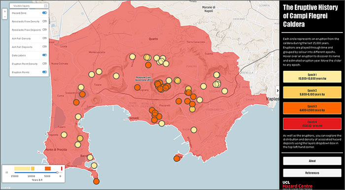
The location of the next eruption of Campi Flegrei is extremely important for scientists and decision makers. One way we can understand more is by looking at past eruptions. This dynamic map was initially made to better highlight patterns that were not clear on static maps. Another version of this map will be translated into Italian and shared to help the general population see where and when eruptions have occurred in the past.
Each circle represents an eruption from the caldera during the last 15,000 years. Eruptions are played through time and grouped by colour into different epochs. Hover over an eruption to discover its name and estimated eruption year or move the slider to any epoch. Explore the distribution and density of associated hazard deposits using the layers dropdown box in the top left hand corner.