Wooden Ships
Created by by Scott Farley, Starr Moss, and Meghan Kelly of University of Wisconsin-Madison.
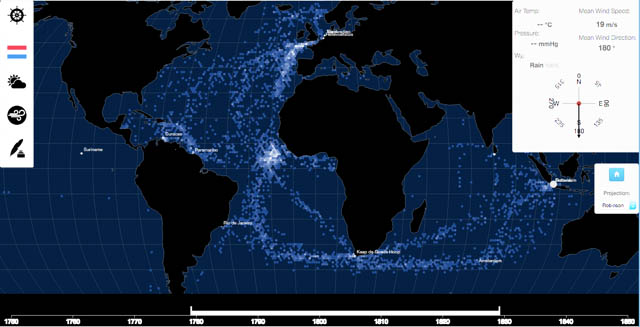
Wooden Ships explores European maritime activity and observations from 1750 to 1850. The data consists of logbook entries written by the captain of each ship. The location of each ship is spatially aggregated in hexagonal bins. Filter the map by country or time to better understand varying shipping patterns by colonial powers. Hover over the ships or hexbins to view summary weather statistics. Click a hexbin to view handwritten log entries about weather observations as well as candid events at sea from the captains! Select ships with particular weather or climatic features, such as temperature recordings or encounters with sea ice. Check out wind speed patterns across the Atlantic. This application will enhance your understanding of the geography and environmental history of maritime trade!
See the project