
Submission deadlines for a host of NACIS 2016 related opportunities are coming up quick. The deadline for registering to present at the Annual Meeting, participate in either of the student map competitions, or apply for a travel grant is May 31, 2016. Mark your calendar, and see below for links.
Be a part of the annual meeting
If you’d like to contribute to a talk, panel session, discussion, or workshop, make sure that your proposals are submitted by the 31st of May. Presentations related to our theme of Mapping for Change are encouraged, but all cartographic topics are welcome! View the Call for Participation for further information and submission details.
Learn more about participating
Student Dynamic Map Competition
NACIS is sponsoring the 16th Annual Student Dynamic Map Competition to promote cartographic excellence and innovation in this versatile medium. Two prizes of $500 will be awarded; one for an individual project and one for a group project.
Learn more about the Dynamic Map Competition
Student Map and Poster Competition
Students who would like to display their works at NACIS 2016 should register for the Student Map and Poster Competition. There are two competition categories: cartographic design and research quality. We encourage all students to submit their maps and technical/research posters for a chance at one of two $500 prizes!
Learn more about the Student Map and Poster Competition
Travel Grants
NACIS has travel grant initiatives that invest in the future growth and strength of the organization. These initiatives (1) encourage student attendance and participation at the annual fall meeting and (2) support the attendance of general NACIS members to attend the annual meeting who could not otherwise attend due to financial limitations. Application deadlines for both the student travel grants and the regular membership grants is May 31, 2016 at midnight CDT
Learn more about travel grants
Get more for your travel dollar and attend two meetings at once.
For those of you who would like to extend your time in Colorado Springs, you’re in luck. This year’s Great Plains / Rocky Mountains Division AAG meeting is taking place in Colorado Springs on the Saturday immediately following NACIS 2016. You don’t even have to change hotels! Visit http://www.uccs.edu/gprm2016/index.html for more information about the meeting.
Nominations for NACIS Board At-Large Members and Student Board Member
A message from Alex Tait, Past President
As immediate past-President of NACIS I have the privilege of chairing the Nominations Committee for the upcoming 2016 NACIS Board elections. NACIS is a vibrant community of diverse scholars, designers and enthusiasts in academia, freelance, and public practice. Each year we hold elections to fill three At-Large Board Member positions and one Student Board Member position. We aim to field candidates with a balanced but incisive perspective, new ideas, and a creative approach to future conferences and other organization activities.
The election ballot will be posted for the membership later this year, prior to the annual meeting, and newly elected members will be announced at the meeting. Elected members are expected to attend the annual NACIS conferences, participate in virtual board meetings (every couple of months), and travel to the spring board meeting (often in Wisconsin). Also, you would contribute in a general way to ongoing discussions, and join at least one committee. Again, the At-Large board position is a two-year commitment and the Student position is a one-year commitment
If you would like to nominate someone or volunteer yourself for nomination, please contact me by April 15: pastprez@nacis.org. Of course, I’d be happy to answer any questions or concerns that you may have.

ALA pre-conference on data visualization
June 23 in Orlando
MAGIRT, the Map and Geospatial Information Round Table, is holding a full-day pre-conference at this year’s American Library Association Annual in Orlando, FloridaJune 23 – 28.
On Thursday, June 23, 2016, join MAGIRT to learn about using data visualization. This pre-conference program, a follow-up to the programs presented at Annual 2015 in San Francisco, will lead participants through a series of hands-on exercises designed to help them learn both data cleaning techniques and data visualization principles.
The presenters are:
- Justin Joque, Visualization Librarian, University of Michigan Libraries
- Angela Zoss, Data Visualization Coordinator, Duke University Libraries
- Andy Rutkowski, Geospatial Librarian, UCLA Library
Check out a full description of the program.
Space is limited, so register soon!
NACIS 2015 has come and gone, and over 350(!) of you have had a chance to make new carto-friends and renew old friendships in Minneapolis, MN.
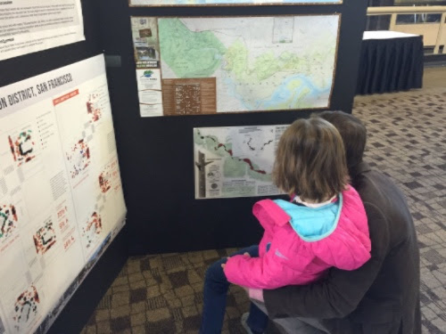
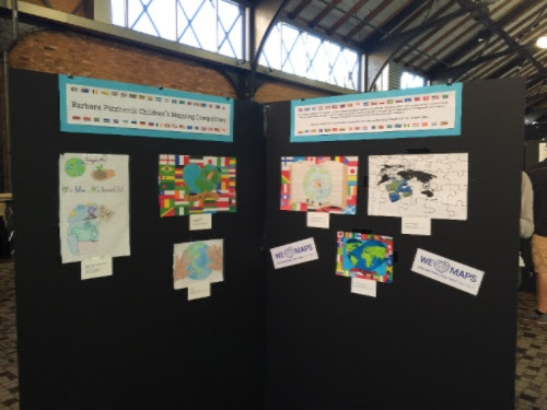
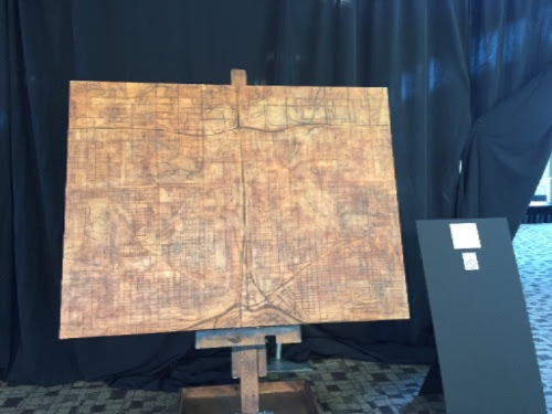
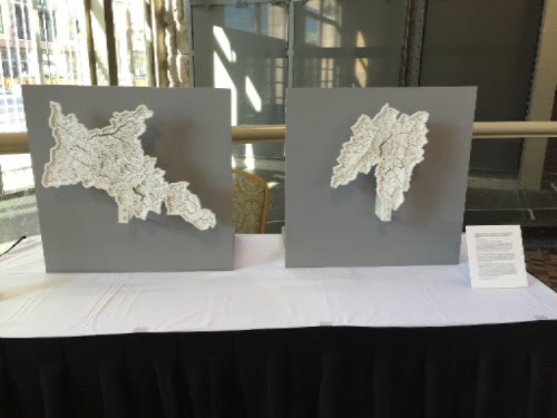
Blessed with an embarrassment of space in the wonderful Renaissance Depot Hotel (a repurposed old railway station), we took the opportunity to put together a blockbuster Map Gallery, including a special Tangible Maps Exhibit, curated by Matt Dooley, Jake Coolidge, and Caroline Rose. Hear more about it, and see Jessie Conaway’s cool floor map, in the podcast of Matt’s interview on MPR. As a part ofInternational Map Year, we also included the 2015 entries from the Barbara Petchenik Childrens’ Map competition from the US and Canada, and we opened the map gallery to the general public for the first time.
Catch up on Talks you Missed
For those of you who were unable to attend the conference, or who couldn’t clone yourself to be at multiple talks at once, many slides, including the Pecha Kucha banquet presentations, are linked in the session descriptions in the online program. If your slides are not yet there and you want them to be accessible, send a pdf or a link to prez@nacis.org and we will get them posted. Check out the conference twitter feed, too, to see comments, reactions, and pictures from the conference. There are even some pictures from the gunpowder mapping workshop—we hope all of those participants successfully navigated the TSA on their trip home, and hope to see some of the products of that workshop at NACIS 2016!
If you have photos from the conference, we’d love for you to add them to the NACIS Flickr pool!
Twin Cities local Kitty Hurley put together this fantastic document summarizing much of what she saw at the meeting, so if slide decks aren’t linked, check out her notes. And, if you don’t like navigating the online program to find slides, you can also find links compiled in a spreadsheet by Jeremy Goldsmith here.
You can find links to the digital maps in the Map Gallery and to entries in the Student Dynamic Mapping Competition (individual, group) online too.
Don’t Lose Touch!

NACIS 2016 Annual Meeting – Colorado Springs
NACIS 2016 will be held in Colorado Springs October 19th–22nd, so start thinking about what you can bring to the meeting! But you don’t have to wait for the 2016 conference to get your dose of NACIS. Keep the conversations going at Cartotalk, on Twitter by following @NACIS, following NACIS news on Facebook, or participating in activities like FixWikiMaps, which recently held a MapLift in conjunction with NACIS.

Still haven’t registered for NACIS 2015 in Minneapolis? Prices go up after Sunday, October 4th! Make sure you get the best deal by registering today.
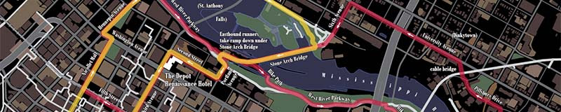
Second Annual NACIS Fun Run and Walk
It’s almost time for another NACIS FUN RUN! Make sure to bring your running shoes and a change of clothes with you to Minneapolis, and join in on a jaunt through the hippy Big-Ten heart of the Upper Midwest’s capital city, with its glittering skyline towering above the roaring falls of the nation’s greatest river. It’s sure to get your heart pounding and provide just the excuse you need for that extra breakfast pastry the morning after… and, let’s face it, each day of the rest of the conference.
The run route’s length is 5.3 miles and the walk route’s length is 3.25 miles. We’ll meet in the Depot Renaissance Hotel lobby at 5:30pm Wednesday evening. For more information and to download a map of the route, visit the event page at sched.org.

Getting from the Minneapolis Airport to Downtown
Getting to the conference venue is easy! Just hop on the light rail at the airport (Blue Line), direction Minneapolis – Target Field, and get off at the Government Plaza Stop. Then walk to Third Ave S, turn right and walk three blocks.
Check out the excellent map that MSP Maptime made of nearby attractions.
If you’re planning on showing work at NACIS 2015, then now is your last chance to get it submitted.
Registration for the Student Dynamic Map Competition and the Student Map and Poster Competition closes tomorrow, September 11, 2015. Eligible students have a chance to win one of four $500 prizes across the two competitions.
Registration to hang your digital or physical work in the Map Gallery also closestomorrow. The gallery is at the center of the opening reception, and we want your maps on display. Share your latest finished work or experimental techniques with attendees over drinks, and help us kick off the Annual Meeting in style.

NACIS attendees get free shipping on Volume 2 of the Atlas of Design by picking copies up at the Annual Meeting.
Combined with your 25% NACIS Member Discount, you’ll save $16 in total. This deal expires at the end of the day on October 5th, so act now to take advantage. Save money and reserve your copy of our beautiful collection of some of the world’s most interesting cartography! Visit atlasofdesign.org/purchase to place your order.
Time is running out for students to register for the mapping competitions at this year’s NACIS Annual Meeting. All students currently enrolled in a certificate, undergraduate, or graduate/post-graduate program are eligible to enter, as long as they have not previously won a top prize in either competition.
Student Dynamic Map Competition
Our 16th Annual Student Dynamic Map Competition promotes cartographic excellence and innovation in this versatile medium. Two prizes of $500 will be awarded: one for an individual project and one for a group project. Deadline for submissions is September 11, 2015. To view the rules and enter the competition, please visit the student dynamic map competition page.
Student Map and Poster Competition
Students who would like to display their printed maps and technical/research posters at NACIS 2015 should register for the Student Map and Poster Competition, for a chance at one of two $500 prizes! There is no entry fee. All entrants will be displayed in the Map Gallery, and the winner will be selected by a ballot of all meeting attendees. The deadline to register is September 11, 2015. For more information and to enter the competition, please visit the student map and poster competition.
Show your work in the Gallery
If you’re not a student, you can still display your maps in the Print and Digital Gallery at the Annual Meeting in Minneapolis. We encourage you to show off your best recent cartographic projects, from experimental techniques to finished products.
You might be saying, “Wait, did you say ‘print AND digital?'” Yes! This year’s Gallery will feature a new digital component that we’re very excited about. We’ll use a “bring your own device” strategy to showcase your online works and interactive maps. Participants will need to submit a small 17″ x 11″ poster that includes a QR code that can be scanned. Attendees will need to come armed with a QR code reader app on their phones and tablets.
If you’re interested in participating, you’ll need to act quickly. All submissions, print and digital, must be registered by September 11, 2015 in order to show in the Gallery.
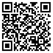
For more information and to submit your work, visit the map gallery or scan the code below.

This summer, we want your help in building maps for Wikipedia! Join mapmakers from around the planet for the first ever MapLift, organized by NACIS and the FixWikiMaps Project. In a series of events from August 28th through September 4th, our collection of volunteers will be contributing their skills to upgrade existing Wikipedia maps and make new ones. For more details, and to sign up, visit nacis.wpengine.com/maplift.
Are you interested in showing off a map of yours? We want to showcase our members’ work on our Twitter (@NACIS) & Facebook pages, and keep the world updated on what we’re doing outside of the Annual Meeting! If you’re a student, a teacher, a professional cartographer or currently making maps as a hobby, feel free to submit. This is not a sponsorship deal and while you may include your name and/or Twitter handle on the map, we want to keep the focus wholly on the creation. We’ll tweet information about the map, so no need to add a link on the picture.
All maps must be in .jpg format, 1500px by 500px, and should be submitted to social@nacis.org.
Student Travel Grant
Deadline: August 31
Each year, NACIS awards travel grants of up to $200 USD to students to attend the annual NACIS conference. Any undergraduate student enrolled in a 2- or 4-year, degree or diploma granting institution pursuing their degree/diploma in geography or a related discipline qualifies.
For more information, head to our grants page.
Student Map and Poster Competition
Deadline: September 12
Students who’d like to display their works at NACIS 2014 should register for the Student Map and Poster Competition. We encourage all students to submit their maps and technical/research posters for a chance at a prize of $500!
Read more about this competition here.
Student Dynamic Map Competition
Deadline: September 12
NACIS also recognizes the importance of dynamic mapping in cartography, and sponsors a Student Dynamic Map Competition, with two categories – Narrative and Interactive, each awarding a prize of $500.
Read more at the dynamic map competition page.
Map Gallery
Deadline: September 12
Enter to submit your work in the 2014 Map Gallery in Pittsburgh. NACIS encourages you to show off your newest cartographic products – from experimental techniques to finished pieces. Join in this showcase of the very best maps that your fellow NACITES have to offer!
Learn more about the Map Gallery.